
1. Give me an overview of the trail?
The Grampians Peaks Trail is a 164-kilometre walk traversing the Grampians National Park (Gariwerd). It provides panoramic views north/south along the ranges and east/west across the plains. Walkers will experience a stunning diversity of landscapes, including rocky ridges, alpine communities, dry and wet forests, heathlands and rivers. There are always some wildflowers blooming and Spring puts on a dazzling, ever-changing display.

The 13-day/12-night trail can be walked in either direction, with the majority of walkers starting in the north. As well as the full end-to-end walk there are excellent overnight and multi-day options: see our Grampians Peaks Loop for a 2/3 day walk; consider the Northern section (Mt Zero to Halls Gap) for an excellent 4-day walk; while south of Halls Gap there’s a variety of options from one to nine days. With car shuffles, or paid transport, the entire trail can be done as a series of day walks (some long days and/or alternative routes may be required).
The trail’s surface varies from section to section due to the terrain and because it utilises existing trails/management tracks as well as a lot of purpose-built walking tracks. However, in the main, it’s a rocky walk: at times we were climbing a couple of hundred metres of stone stairs of varying heights & widths; at others, we were picking our way along rocky ridgelines.
The majority of the trail is graded 4: Bushwalking experience recommended. Tracks may be long, rough and very steep. Directional signage may be limited. Other sections are grade 3 and some grade 5.
See how Australian walking tracks are graded.
The Grampians Peaks Trail trail climbs a cumulative 7,500+ metres, often on beautifully crafted steep stone stairs. There’s some minor scrambling required and in areas like the Major Mitchell Plateau you’ll need good navigation skills if the weather is poor (and it can change in a heartbeat).
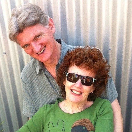
We’re in our mid to late 60s and while we found it physically demanding, we completed the trail without incident. We met a couple who walked double sections for the entire length of the trail, completing it in 6 1/2 days, although they wished they’d done the hardest two sections, Barri Yalug to Durd Durd, separately. We also met parents with young children and a group of high-spirited school students walking sections of the trail.


2. Where is the Grampians Peaks Trail?
The Grampians National Park is located in western Victoria. This area has been known to its indigenous inhabitants as Gariwerd for tens of thousands of years. Gariwerd/Grampians is approximately 260 km west of Melbourne. Halls Gap is the only town within the National Park and it’s about 3 hours from Melbourne or 5.5 hours from Adelaide by car. By public transport, it’s 3.5 hours from Melbourne.
Halls Gap has hotels, motels, bars and cafes, supermarkets, an outdoor shop and transport options. For most walkers, it is a logical starting and resupply point. It also provides the opportunity of a night in town after a few days on the trail.
Mt Zero carpark is the northern terminus of the Grampians Peaks Trail, while it can’t be reached by public transport there are companies providing transport for walkers. Dunkeld, the southern terminus can be reached by public transport from Melbourne, Hamilton and Halls Gap.
Note: while the walk starts at Mt Zero carpark, Mt Zero itself isn’t a part of the official trail but can be climbed as a day walk.


3. Why, and when, should I walk the trail?
The Grampians Peaks Trail is already regarded as one of Australia’s pre-eminent walking trails. It’s a must-do trail for nature lovers, long-distance walkers, birders, wildflower enthusiasts (orchids, anyone?), peak baggers and quite possibly stone masons.
You can walk Gariwerd/Grampians at any time of year if the weather is kind. Summer can be extremely hot and bushfires are a real threat. Winter can be cool and wet (snow is possible) and there could be limited visibility, slippery rocks and no views.
Late Summer/Autumn and Spring are generally milder seasons and while there will be some wildflowers out at any time of year, they’re at their most spectacular in Spring. Warmer Spring days will also bring out many reptiles, including snakes.
We walked the trail in October (after the Victorian school holidays) and loved the wildflowers and the quieter trails. The weather was variable with cold, wet and windy conditions, followed by sunshine and blue skies, followed by more rain and wind.
We walked one section each day for 13 days and camped out each night except for the 4th night when we stayed in Halls Gap. There are dedicated camps at the end of each section and they all have:
- Access to water. There’s at least one serviced tank (i.e. filled up by Parks from town water) in each track section, usually between campsites. However, every camp has a water tank that, in the main, relies on rainwater. The GPT Facebook group is a good place to ask about water availability. Parks recommends treating the water.
- Toilets.
- USB charging outlets.
- Tables and seating.
- Campsites. All have separated tent sites with either timber tent platforms and/or gravel sites. Seven of the camps also have roofed shelters in which you can cook, chat with other walkers and shelter from inclement weather. The Bugiga shelter (the night after Halls Gap for us) is an open-ended tunnel with bench seats down each side while the shelter at Yarram has no doors but everything else, including a fabulous view. The four camps without shelters have open-air gathering places with tables and seating; these are Barri Yulag, Duwul, Durd Durd in the central section and Wannon in the southern section.


4. How do I plan my trip?
The practicalities:
- Book, and pay for, overnight campsites on the Parks Victoria website. The website also has information on preparation and safety.
- You must carry a fuel stove (if you want hot food/drinks) as fires are banned all year.
- As above, there are water tanks in each section, although you should check water availability before setting off.
- Food drops: Jimmy’s Creek Road crossing is an ideal food drop location, coming as it does midway between Halls Gap and Dunkeld, but you can have as many food drops as you like.
- The Grampians Peaks Trail takes you into rough rocky country and is not always in mobile phone range. You need to carry a basic first aid kit, be able to treat water and consider carrying a Personal Locator Beacon or similar. The Aust Maritime Safety Authority has useful information on beacon types and models.
- The Visit Grampians website has useful information about the area.
- Our key costs: Campsites, $50.40 per site (not per person); transport for two from Halls Gap to Mt Zero, $180; one food drop $80 (25 lt container supplied).
We used Grampians Peaks Walking Co to transport us from Halls Gap to Mt Zero and for a food drop. We found them friendly and helpful. In Halls Gap, we stayed at the YHA. They were super helpful in allowing us to leave provisions with them while we walked the northern section and, after four days walking, they let us in early so we could have a shower and wash our clothes (they have washing and drying machines). We sipped a glass of excellent local wine at the Grampians Wine Cellar and enjoyed the food (and the robot) at the Spirit of Punjab and the Halls Gap Hotel.
If you want someone else to do some of the heavy lifting, there are companies (including the Grampians Peaks Walking Co) that offer guided and self-guided supported trips. See the Grampians Visitor Information Centre for more information.


5. How do I find out what walking the Grampians Peaks Trail is like?
If you haven’t already read our story of walking the Grampians Peaks Trail, then click here. Hopefully, you’ll be inspired to start planning your own walk.
We shared shelters along the way with Helen and Geoff. Their website, Slower Hiking, has their story of walking the GPT (as well as other walks and lots of information on gear, food, etc).


Disclosure
We do not receive payments, commissions, or freebies. If we mention a specific product/service or link to another website, it’s because we think it might be useful in planning your walk. There are likely to be alternatives to the products and services that we mention and we suggest that you assess the best options for your needs.
You might also be interested in some of our other adventures…
- The Grampians Peaks Trail Loop a 2/3-day walk from Halls Gap
- The Surf Coast Walk: two days traversing the clifftops, beaches and Moonah woodlands of Victoria’s west coast.
- The Great Ocean Road by bike: we start in Halls Gap, ride to the coast, along the famous Great Ocean Road and finish at Geelong.
- The Tour du Mont Blanc: an epic 170-kilometre walk around the Mont Blanc massif, through a dazzling landscape of snow-capped peaks, ice-scarred mountains and tumbling glaciers.
Very helpful – thank you!
Do you know if the trail is specifically ONE WAY only? To get a booking on the dates we are after, we are considering going in reverse for a short 2 night “taster”.
Kirsten
The booking system has been refined a couple of times in response to feedback and we understand that it can now be booked in either direction.
This page of Parks website is clear (although other pages, presumably older, give different advice). If you have trouble booking, then we recommend giving the parks office a call, they are generally pretty helpful: https://www.parks.vic.gov.au/places-to-see/parks/grampians-national-park/things-to-do/grampians-peaks-trail/changes-to-booking-system
Best wishes
Michael & Anna
Very nice indeed, Michael and Anna, and thank you for the mention.
You’ve covered all the key points for anyone thinking of doing this hike.
Cheers
Helen and Geoff