
Grampians Peaks Trail, Gariwerd, Australia
Prelude
The Grampians Peaks Trail is an epic walk, full of beauty, grandeur and challenge. Along its 165 kilometres, it climbs over rugged peaks and crosses tough, rocky terrain as it traverses Gariwerd from Mt Zero in the north to Dunkeld in the south. Are we being foolhardy, setting out on a 13-day journey into the heart of this ancient, craggy country?
We leave home in the rain, shouldering heavy backpacks. From the train, we gaze at land cleared of trees and scarred by mining. Water lies everywhere, attracting white-faced herons and a proliferation of ducks. Trees are blossoming and the yellow of canola spreads across the slopes. Lambs frolic in the spring green paddocks.
In Ararat, we transfer to a bus for the last leg to Halls Gap, passing through small country towns flanked by avenues of trees that honour the war dead. Our view is coloured by clouds of pink blush corellas and the smoky blue of mountains, their peaks tilted towards the sun.


It’s Petyan (Spring) in Gariwerd, the season of wildflowers, warmer days and tempestuous weather. The bush bursts into life and the Emu constellation appears in the night sky.
Gariwerd is the name in the local Jardwadjali and Djabwurrung languages for the striking mountain range that rises from Victoria’s western volcanic plains. In the time before time, the Great Ancestor Spirit Bunjil created this world; the mountains, the lakes, the forests, the rivers and the plains. At the end of his time on Earth, Bunjil rose into the sky and became a star. He remains up there to this day, the protector of the natural world, its people and their beliefs.
North (Mt Zero to Halls Gap 4 days, 54.5 km)
At dusk last night, great mobs of kangaroos, emus and fallow deer moved shadow-like through the landscape. The forecast warned of wild storms but we woke to a fine, crisp day. Before we set off, we visited the Gulgurn Manja rock art shelter and paid our respects to the traditional owners of this country.
Mt Zero is the northernmost peak of Gariwerd and the start of what we expect to be an adventurous 13 days on the Grampians Peaks Trail. Cone-shaped, it stands sentinel-like, watching out over the Wimmera plains. From its base, it’s a steep climb up to a 500-metre-high rock platform. Catching our breath, we pause to take in the commanding views of Mt Stapylton and the sweeping wave of orange rock that is Taipan Wall. High on the wall climbers are hanging off ropes, honing their skills while enjoying breathtaking views along the Gariwerd ranges.
From Flat Rock, we follow the uneven track down into Stapylton Amphitheatre and then up steep rock slabs past the aptly named Bird Rock. The climb up to the Mt Stapylton viewpoint is an easy scramble. The views to the south and west are spectacular and the wildflowers resplendent. Seasonal mountain pools brim with water after the recent rains.


We walk out onto an exposed ridge, the wind howling like a dervish. Gashes in the rock face reveal the source of the red ochre used in ceremonies. Descending through the forest, we cross creeks where the water pools and falls. A Grampians Mountain Dragon warms itself on a rock ledge. For a time, we follow a meandering path on a sandy track until we drop down into Barigar, our home for the evening. Nestled in the valley and surrounded by mountains is an architect-designed timber and oxidised steel shelter that we retreat to once we’ve set up our tent. It’s designed to be a refuge for 24 people but there are just six of us here this evening, the forecast having deterred several fairer-weather walkers.
Rain overnight and an owl calling. Boo-book; the sound soft and low in the darkness. A tinge of pink in the early morning sky. Emu tracks in the sand. The gradient profile shows a day that includes a gradual climb, a dip into Troopers Creek and then a longer climb up to the Gar campsite.
Waterfalls backed by etched rock walls and overhangs that hold an air of mystery. A small mountain lake and expanses of heathland. In some of the roughest places, the most delicate of orchids flourish. Hundreds of other species are flowering in what looks like a mass planting designed to awe the senses. Clouds of sulphur-crested cockatoos add their raucousness to the dazzling spectacle.
From the edge of the Gar escarpment, we have views across the craggy mountain ranges to the plains that lie beyond. It’s an ancient country, full of beauty and drama, formed at the bottom of an inland sea 40,000 million years ago. Tectonic activity forced layers of sediment to fold upwards, creating a series of peaks and ridges that erosion and weathering shaped into Gariwerd’s distinctive cuestas; landforms with a steep escarpment on one side and a gentle back slope on the other.


Even though it’s tough going across the rocky terrain and up the steep stone staircases, the track itself is a thing of wonder. The work of master stonemasons, it’s been designed and laid with great skill and artistry.
At the Gar campground, we pitch our tent in a swirling mist. Not long afterwards, heavy rain puts an end to our intention to climb Mt Difficult (Gar) today. We spend what remains of the afternoon in a shelter built of charred black timber designed to reflect the moody, dark rock faces. An ultra runner comes through on her way from Mt Zero to Halls Gap, a 4-day walk for us but a one-day run for her.


A glow in the sky; early morning light after rain. We start the day doing what we couldn’t do yesterday by climbing to the summit of Gar. Gar means big mountain and today from the summit the views extend to the western horizon. We take in sparkling Lake Wartook and range upon range of mountains, including the Serras and the Victoria Range.
It’s a day of following a trail that rises and falls over high points, dips into saddles and crosses rocky slabs. On the precipitous escarpments, the sun breaks through but the wind remains bitter. The rugged physicality of the walking is offset by the sublime beauty of the landscape. Wildflowers, including Grampians spider orchids and purple coral pea, shimmer. Glistening sundews and bladderworts grow up from the mossy humps between rocks. The light reflecting off ribbons of water glints like molten silver in the valley below. Eagles soar high above us. The songs of a myriad of small birds are the refrain of our afternoon.
At Werdug camp, the night sky glitters like ice. We have a fitful night’s sleep as the temperature hovers around zero. On this high, exposed knoll the wind rages and we’re woken by trees crashing to the ground in the forest below. The ancient spirits are stirring.


It’s the coldest morning on the trail to date. A wallaby crosses the track in front of us as we walk up through a forested gully to the escarpment. This high up, at 829 metres, it’s all rocks and moist air and a vast expanse of sky. We can see Bear Island in the middle of Lake Wartook and farms stretching beyond it, all bordered by trees. To the south, we can see some of the peaks we’ll climb in the coming days; Redman Bluff, Mt William and the Major Mitchell Plateau.
We meander across the escarpment, past wildflower gardens and crenulated surfaces. The monumental weather-carved rock formations take on the appearance of ancestral creatures. Descending through stringybarks and a mass of white flowering tea trees, we look across to rugged, heavily forested mountain slopes. On the edge of Halls Gap, we see a snake curled around a rock and a kookaburra on a fence post, both unbothered by our presence. From here, it’s a short walk out of one world and into the Saturday afternoon busyness of a tourist town.


Central (Halls Gap to Yarram shelter 5 days, 67.2 km)
An afternoon and an evening in Halls Gap. A hot shower, clean clothes, a couple of glasses of local wine and a satisfying meal. It’s our only taste of town life since setting out on the Grampians Peaks Trail and will be our last until we reach Dunkeld in nine days.
We wake to a world shrouded in mist. A shaft of light illuminates St John’s bush church. On our way out of town, we run into Ant, a local farmer and fellow long-distance walker. He drove us to Mr Zero four days ago and now offers to pick us up if we get into difficulty anywhere on the Trail. Other locals give advice and assistance; on and off the trail there’s a friendly welcoming vibe.
Four kookaburras on a wire. The sun warming the sandstone. The sky flecked white with cockatoos. We follow Stony Creek, walking against the flow until we arrive at Venus Baths. Water cascading. Ferns basking in the spray. Rock pools holding reflections of trees and sky. All the waterfalls; Splitters Falls, Bridal Falls and, higher up, Stony Falls. Water rushing through rock and creating rivers and creeks anew.
Bypassing the remarkable rocky gorge that is the Grand Canyon, we turn towards the Pinnacle. A path over exposed rock slabs and a steel mesh walkway leads us to Cool Chamber. From there, it’s a steep climb up into Silent Street, a 30-metre-long, deep, narrow canyon. The country is magnificent. Shaped by wind and rain and altered by fire and flood, the Wonderland Range is a drama of ice-etched rocks, caves and monumental stone sculptures.
Sitting in the sun on the summit of the Pinnacle, we take in the majestic panorama; sandstone escarpments, forested slopes, a lake, and smoke rising from the plains below. By mid-afternoon, the warm air vibrates with bees and smells as sweet as honey. Skinks dart into the undergrowth as we pass.


The walking eases. The last climb of the day is a gentle one; up to Sundial Peak, so named because it receives the first and last rays of the sun each day. We look out to the Mt William Ranges, the cliff faces of Mt Rosea and the vast plains to the east. The late afternoon sun warms us as we sit among Callitris pine and grass trees, watching a black wallaby nibbling on bright yellow flowers. Then we follow the contours of a hill, down to Bugiga. Only two other people are using the hangar-like shelter this evening; Helen and Geoff from South Australia. They are also walking the Grampians Peaks Trail end-to-end so we’re likely to see them daily from here on.
As we lie in our tent in the shadow of Mt Rosea, the soft darkness enfolds us and we drift into the sleep of the content.


Owls calling throughout the night. A kookaburra leading the dawn chorus. The rising sun lighting up the sandstone cliffs. We climb up through tall forests of Mountain Grey Gum and Stringybark and come out to a clearing. Through a gap in the mountains, we can see mist drifting up from the shadowed valley. The light catches the red breast of a flame robin sunning itself on the edge of a precipice.
It’s a steep climb out of the forest and across the bridge at the Gate of the East Wind up to Mt Rosea. We navigate a path through narrow openings in the escarpment, under overhanging rocks and over boulders. It’s strenuous work that results in a broken walking pole but, fortunately, no broken bones. At 1009 metres, Mt Rosea is one of the highest peaks in Gariwerd. The views from the summit are sublime and we linger for an hour or so, taking it all in; the water in the high rock pools tinted blue by the sky, black skinks basking on the rocks, red, white and pink flowering heath, the floral emblem of our State.
We wind our way down through scrubby, storm-damaged country, scrambling over fallen trees. Even though it’s downhill, the going is slower and harder than we anticipated. The length of the descent and the several kilometres of tough, steep climbing that preceded it have taken their toll.


Across almost-dry rivers, past springs where bright-green ferns grow, we take the track through the rocky country to Barri Yalug. There’s no shelter here, just an open gathering place with tables, bench seats and a timber windbreak.
In the deep darkness, we marvel at the silvery-white arc of the Milky Way as its stars and cosmic dust sweep across the sky.
We set out as the world is brightening. Sundews glistening in the soft early morning light. Trees daubed red with the wispy crests of gang-gang cockatoos. Bands of fog sitting just below the peaks and hovering above the lake. The summit of Mt Rosea obscured. Today is the biggest elevation gain of the Grampians Peaks Trail. We’ll climb 700 metres from Barney Creek to Redman Bluff. Less than a kilometre in, we locate our food drop. For the next two days, we’ll be hauling seven days of food over the most challenging sections of the trail.
We pass the open steel flume that once carried water from the Grampians to the goldfields of Stawell. As we climb, we have splendid views out over the tilted, twisted, forested ranges. The honey-coloured sandstone rock outcrops high up on the ridges remind us of the mediaeval forts and castles of Europe.
There’s prettiness in the gardens of wildflowers and soft grasses, but it’s rocks that dominate the day. Exposed rocky ridges. The steep stone steps on the edge of the Seven Dials escarpment. The boulders we have to clamber over to reach the summit of Redman Bluff. All six people camping at Duwul tonight agree that it was an arduous day. One of them wonders if they have another such day in them.


The moon and the planets are still bright in the sky this morning. The forests are all shades of olive, ochre and misty grey. It’s sunny but windy; a lazy wind according to Helen & Geoff; a wind that is too lazy to go around you and so goes right through you. Ahead lies Mt William, the Major Mitchell Plateau and Durd Durd; all high, exposed places that are hazardous in poor weather.
To our surprise, the climb up to Mt William (Duwul) is on a tarmac road. While not the most natural of track surfaces, it does provide respite from the rocky paths of the last few days. Mt William at 1167 metres is one of the two highest mountains in western Victoria (the other is Durd Durd). Signs warning of falling ice. It’s a stunted, windswept site but the views from the summit are spectacular. We can see clear across to the Serras, the dramatic, saw-toothed range of mountains that stretch from east to west.
Between Mt William and the Major Mitchell Plateau lies the forested Boundary Gap. People describe the climb into and out of the Gap as being akin to descending into Dante’s inferno.
A long, steep staircase of stone and then, with leg muscles burning, a final push through boulders brings us to the northern extent of the Major Mitchell Plateau. Following the edge of the escarpment, we clamber over rock slabs and across steel mesh walkways to Durd Durd. From here, the second of Gariwerd’s highest mountains, we look out over expanses of water. The wetlands below are a haven for endangered birds including brolgas, famed for their elaborate courtship dance. There are traditional Aboriginal dances that mimic the bird’s graceful performances.
Another scramble upwards, this time on a path lined with banksias, flowering heath, grevilleas, pea bushes and orchids. The scent of the flowers mingling with the pungent smell of wild thyme makes for a beguiling perfume. Then a steep, rough descent down a rocky ridgeline to our camp for the night.
We’re enjoying fine weather in this Central section, providing us with magnificent views and lessening the danger held in the steep, rocky terrain. But mares’ tail clouds have appeared in the sky, indicating a change is on the way. Before long, the wind picks up and the glow of a storm appears low above the horizon.
It’s almost dark when some hikers arrive at Durd Durd campground this evening, including a couple at the end of a gruelling, 28-kilometre day. There’s a general uttering of expletives and accumulation of fatigue in the camp, brought on by the consecutive days of challenging terrain.


We wake to rain battering the world. It’s the last and shortest day of the Central section of the Grampians Peaks Trail and there seems no reason to rush. We lie in our tent, reading while we wait out the storm. Last night, it was sound that soothed us as we lay and listened to Robert Macfarlane’s poetic telling of his crossing of the iconic Cuillin Ridge on the Isle of Skye.
In a break in the weather, we set out towards Jimmy Creek. Mist shrouding the encircling mountains. Wildflowers quivering; elegant red spider flowers and blue tinsel lilies. Rock splashed orange with lichen.
Storm light. Passing showers. Hail. After the storm, the twittering of birds. New Holland honeyeaters, pardalotes, wattle birds and wrens. The brooding presence of the mountain peaks. Then more rain. So the morning passes. And the afternoon? We spend it high up on a saddle, looking out at the unfolding drama of the sky from the shelter at the Yarram campground.


South (Yarram to Dunkeld 4 days, 51.4 km)
We wake to rain squalls. After an initial steep, slippery descent, the going eases. We still have 50 kilometres to walk but we sense a let-up in the physicality of the walking and a certitude that we have it in us to complete the Grampians Peaks Trail. Ascents of Signal Peak, Mt Abrupt and Mt Sturgeon lay ahead but a lightness of being takes hold in us.
Earth the same colour as the massed wildflowers. Emu scats on the track. Slender trees with fur-like bark. A malcontent tiger snake, stranded by the cold. As the soil changes, so does the vegetation. A rocky knoll that is a botanist’s paradise captivates with its rich diversity of plants and flowers. Following the ridge line, we climb up and down five more knolls, enjoying views towards Mt Nelson, the double peaks of Wudjugidj, and the swampy country that lies to the east.
The track follows a spur that takes us into the forest before arriving at a grassy area of reclaimed farmland. Come early evening, emus and a mob of kangaroos graze close to the windswept Wannon campsite. As we eat, we watch young male kangaroos develop their fighting prowess by playboxing. Before long, a storm sweeps south along the Serras and we beat a retreat to the shelter of our tent.


The utterances of nocturnal creatures. The incantations of the dark bush. In the morning, we descend a knoll through woodland and swampy, open grasslands; past an ancient spreading wattle tree and gnarled banksias. We imagine potoroos and bandicoots scurrying through the heathy understorey. And wonder at the thin, neon-yellow canary worms, their vivid colour designed to repel predators.
The rain comes and goes. Mist shrouds the forest, transforming it into a mysterious, haunted place. The peaks and valleys of the Serra Range dissolve into air. As does the rugged Victoria Range, home to most of Gariwerd’s rock art, some of it dating back more than 20,000 years.
We walk on a track that sidles around the hill until we reach the ridgeline. There’s a steep gully or two to navigate but in the main, the track favours the walker. The rain clears and from the Djardji-djawara shelter, we can see the way we’ve come, almost as far back as Mt Zero.
Just before sunset, a rare vertical rainbow appears from behind the mountains. These rainbows are formed by ice crystals rather than raindrops and according to folklore, if a vertical rainbow appears, rain will fall within the next 24 hours.


There’s a crowd at Djardji-djawara this evening; the numbers swelled by weekend walkers, including two children on their first overnight hike. Most people are content to sit quietly in the shelter; daydreaming, chatting and/or playing cards. Not the small girls though. They run and climb and explore for hours, only stopping when the darkness sends them scurrying to the sanctuary of their mother’s tent.
A dream of a magnificent burnt orange and indigo owl; a creature from a fable. A day that starts with a gentle climb up through rocky shrubland followed by a steeper climb, up past great rocky outcrops and overhangs where ancient spirits linger. Red rocks, etched with lines so blue you can see where the sea was once upon a time.
Eagles swoop down so close we can see the intricate detail of their flight feathers. When they ascend, they disappear into an unseen, unknowable realm. Bunjil, the creator, turned himself into a Wedge-tailed eagle so he could soar above the land and keep an eye on everything. When you see Bunjil you feel safe, a connection knowing that you do not walk this country alone. You are under the guidance and protection of a greater presence, a creator spirit.


We climb onto the northern flanks of Signal Peak on a track that alternates between rock steps and a jumble of boulders. Zig-zapping steeply, we reach the top of the cliff line and, before long, the summit of Signal Peak. Between rain squalls, we have views to the southeast and down onto swamps and grazing land.
We continue, hugging the escarpment as we scramble over rock slabs and up steep steps to the exposed rocky summit of Mt Abrupt. On a clear day, there are magnificent views of the Serra Range to the north and Dunkeld to the south. Today is not one of those days. All we experience is a great void of whiteness. It’s wild and windswept up here at the summit’s highest point and we’re in danger of being blown away. We’re relieved to descend to a sheltered bowl and find ourselves in a calm, enchanted forest. Mist swirling, Lichen-covered trees. A mass of white, yellow and mauve wildflowers.
It’s only an eight-kilometre walk today and we make it to the Mud-Dadjug shelter by early afternoon. A local farming family out for a wander stops by for a rest. They’re fat lamb producers and say they need rain for their pastures. Not long after they head for home, a huge rainstorm hits. They have their wish, even if it means they’ll arrive home cold and wet.
There are six walkers at Mud-Dadjug; four of us are one day away from completing the trail end-to-end. Rain lashes the shelter. The cold makes its presence felt. We can make out the lights of Dunkeld, still far enough away not to diminish the wildness pulsing through the night.


We set off in heavy rain on our 13th day on the Grampians Peaks Trail. We’re soon in the forest; a gentle landscape of grass trees, pines and a myriad of pink finger orchids. We climb to the summit of Bainggug before following an undulating track that takes us past etched rock faces and under rock overhangs. The rain comes and goes as we climb to the summit of Mt Sturgeon, the southernmost peak of Gariwerd. The views on the way up to and from the summit are magnificent. The imposing Mt Abrupt in all its splendour and range upon range of ancient mountains; the Victoria Valley to the north and the vast volcanic plains to the south.
An elevated steel walkway that hugs Mt Sturgeon’s southern face takes us down into open woodland. We come to a boundary fence that delineates public land from private. On invitation, we enter and meander through lush farmland, crossing the Wannon River a couple of times and weaving through stands of gnarled and twisted ancient River Red Gums. The path continues along Salt Creek before landing us in Dunkeld, a small town at the southern tip of the Great Dividing Range. It’s a Monday and not much is open but the one cafe that is suffices. We order lunch in a celebratory mood, pleased to have walked the epic that is the Grampians Peaks Trail and arrived at its end in a state of grace.


Epilogue
The Grampians Peaks Trail takes the walker on a journey into the dramatic world of Gariwerd; its craggy peaks, sweeping slopes, massive sandstone cliffs, extensive forests, rocky outcrops, waterfalls, creeks and rivers, spectacular spring wildflowers and breathtaking views across time and space. With its 7,500 metres of ascents, rocky terrain and constancy of effort, it’s a strenuous and, at times, an arduous walk. But the further we ventured into Gariwerd, the more seduced we were by its rugged beauty and continuing connection to its rich Aboriginal heritage
Walking the trail end to end gave us an appreciation of the traditional owners’ understanding of Gariwerd as an unfolding narrative. As they moved along their ancestral Dreamtime tracks, retelling their creation stories, they brought their country alive through recitation of song cycles, dancing and corroborees, leaving their marks on rocks and sand; their voices echoing across Gariwerd – alive with the spirit of its ancestors.
————–
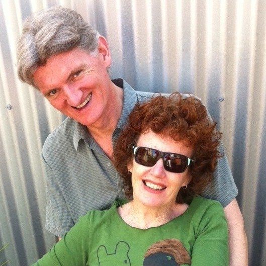
Thanks to Helen McKerral for taking the photograph of us near Mt Rosa. Helen and her partner Geoff have a great blog, Slower Hiking, with tales of adventures and information about hiking gear.
You might also be interested in our story of walking the 3- day Grampians Peaks Loop, the Larapinta Trail or perhaps the Via degli Dei (Path of Gods) in Italy
Just beautiful, thank you Anna and Michael for showing us parts of Gariwerd we would never see ourselves, felt like home! Take care, happy walking i this new year.
Much love, Marg & Mike
Marg & Mike
Thank you, your kind words are greatly appreciated. We look forward to returning again and exploring more of the amazing Gariwerd.
What a lovely perspective of the hike. It’s always amazing reading different people’s experiences of the trail, even though we walked at the same time we saw different things.
Cheers
Helen and Geoff
Thanks Helen. And thanks to you & Geoff for your company en route and all we learnt from you about wildflowers, slow hiking and lightweight gear.
spectacular. unbelievable scenery and views. thanks for sharing. ray
Thanks Ray. We’re pleased you enjoyed the ever changing landscapes of the Grampians Peaks Trail. xx