
1. Why would anyone want to walk 2,000 km?
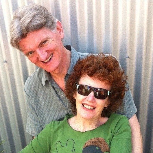
It’s a very good question and one that we asked ourselves when we met Helaine on the Via de la Plata in 2008. She had started and intended to finish the Via Francigena. To be honest, we thought it a crazy notion.
Then, towards the end of 2021, after two years of COVID lockdowns and restrictions, we started wondering how we should respond to the constraints; sometimes we hadn’t been able to walk further than 5 km from our home (Melbourne, Australia). As we talked, it became clear that to put COVID-19 behind us we needed to walk, and the further the better. Helaine and the Via Francigena re-entered our consciousness. To walk 2,000 km over three months through five countries felt like the appropriate way to embrace a newly re-opened world.
The Via Francigena is the perfect walk for those seeking a long-distance pilgrimage without the crowds of the main Spanish routes. It’s relatively unknown, especially along the French section, and there are many variations and possible adjustments to the route: you can pioneer your own way (albeit with a GPS route on your phone). There’s also a range of excellent resources to ensure that it’s easy to plan and undertake.
If you’d like an idea of what it was like to walk the Via Francigena, our series of short accounts of walking from Canterbury to Rome could be a good place to start.

2. How far is it really, how long will it take and will I meet anyone else?
Almost every source and signpost has a different answer to how far it is, ranging from 1,600 km to 2,200 km. And there are so many possible route variations that every pilgrim is likely to walk a different distance. We think 2,000 km is a reasonable estimate and it rolls off the tongue easily.
There is also, perhaps not surprisingly, disagreement on the location of the halfway point. Grand St Bernard (St Bernards Pass) is the highest point of the Via Francigena and it’s approximately halfway. For us, it was the physical and psychological halfway mark: ‘it’s all downhill from there’ was often the response when talking about the Pass with fellow pilgrims.
It took us 83 days to walk from Canterbury to Rome, an average of 24 km per day, including rest days. Over the entire journey, we took seven full rest days and quite a few semi-rest days, arriving early enough to leave plenty of time to explore and/or relax.
In France, we went days without seeing another pilgrim and only on a couple of occasions did we see another pilgrim while we were out walking. In Switzerland, the route is more defined (the very big mountains on either side limit route variations) but we still had the night’s lodgings to ourselves more than once. It wasn’t until we were two weeks into Italy that we began to see more pilgrims. Then, as we approached Rome we became part of a small band of pilgrims that coalesced, mostly walking alone during the day but meeting in the evenings for an aperitif and dinner.


3. How much does it cost and where can I stay?
Compared to Camino routes in Spain there’s far less pilgrim-type accommodation on the Via Francigena, especially in France. Consequently, through France, we often stayed in cheaper hotels, pensions and private gîtes. We also used Booking.com and Airbnb. These options are more comfortable (and safer Covid-wise) than a dormitory bed in a Spanish Albergue, and proportionally more expensive.
We often paid around €60 per night for accommodation for the two of us. In Italy, as we got closer to Rome, the number of Albergue-type places increased and the cost drifted down towards €20 – €30 per night. On occasions, either because we wanted a treat, or there was no alternative, we paid considerably more. You can download a list of the places we stayed, with some brief notes and prices here (or use our Contacts Page to send us a request).
There are few pilgrim menus, especially in France. Consequently, the food is tastier, more varied and comes at a higher price.
We didn’t carry a tent. Camping in official campsites is marginally cheaper (although we don’t recall there being a lot of them) but for us, the saving wasn’t worth carrying the extra weight. We met a young woman who stealth-camped most of the way across France. It’s a cheap way to travel but you do have to carry more weight, set up camp late in the day and get up early, so you’re not seen by the farmer on whose land you are camping. In Italy, stealth camping is much trickier and the accommodation cheaper so most pilgrims give up on camping.


4. Will I cope without fluent French and Italian?
Of course, it would be easier and culturally more rewarding if we spoke French and Italian, but we don’t and so had to make do. We practised basic French on Duolingo for a couple of months before leaving and while this didn’t give us anywhere enough language to converse with the locals, it improved our comprehension and gave us enough confidence to make basic requests for accommodation, food, drink, etc.
Sometimes, our hosts or fellow pilgrims generously booked ahead for us and we also found Tourist Offices very helpful. The wonders of Google Translate enabled us to prepare enquiries to be messaged or emailed to accommodation providers. Often our accommodation choices were based on if the host had a mobile (cell) phone or email address, although we found the response improved when we used text messaging. We also used Google Translate Conversation mode on occasions to engage in conversation with our hosts over dinner or to ask for specific assistance.
We found a great deal of goodwill, despite us severely mangling both the French and Italian languages. So our advice is not to let the lack of language hold you back from starting, but prepare yourself as best you can. A few key phrases and a positive attitude will be extremely useful.


5. When should I go, how long will it take and what is it like to arrive in Rome?
As with many walks, Spring and Autumn are the sweet zones for walking the Via Francigena. In essence, pilgrims want to avoid both snow on Grand St Bernard and the heat of the Italian summer. There’s often snow on the Pass until early June. By August, Italy is likely to be insufferably hot and accommodation harder to find because the Italians flock to the coast, leaving their villages deserted. Picking a mid-June crossing of Grand St Bernard gave us our start date and estimated arrival date in Rome at the end of July.
The Schengen zone generally has a 90-day limit for tourists and while it doesn’t apply to us (we have Irish citizenship) we thought that 90 days was about right for the journey, although we hoped to shave a bit off and leave a margin if we needed to rest or recover at any point. In the end it took us 83 days (3 May to 25 July 2022).
Arriving in Rome is nothing like walking into Santiago de Compostela. St Peter’s Square is full of well-dressed, clean-smelling tourists. You may (or may not) see another pilgrim but no one else will have a clue why you are there with your backpack and sweaty clothes.
To receive our Testimonium we were directed to the cloakroom where a disinterested attendant handed it over and told us to fill it out ourselves. The one concession the Vatican makes for pilgrims is that we could go straight to the security gate, avoiding waiting in the very long queue (beware of knives or other sharp objects in your backpack as you will have to choose between turning back or losing them).
Note: The Via Francigena association reports that the Vatican now has a dedicated pilgrim desk and holds a Pilgrim mass at 18:00 each day.
For us, the emotional finish of the Via Francigena was the Vista Panoramica di Roma. Our friend Arturo arranged for our small band of pilgrims to meet there and share a bottle of wine before continuing to the Vatican. We spent an hour or so chatting quietly about our experiences, looking out over Rome and the great Dome of St Peter’s, and contemplating the end of a wonderful journey before descending into the chaos of the city.


6. How do I plan a 2,000 km journey?
It’s obvious advice but worth repeating, carry the lightest possible pack! We had a change of clothes, a lightweight fleece (needed in France but not Italy), a lightweight down vest and beanie in case it was cold crossing the Alps (not needed and posted back to London as soon as we entered Italy), a basic first aid kit, an umbrella that could be attached to our packs and used for sun and rain, wet weather jacket and pants, as well as a phone, battery pack and a camera each (Sony RX100M7). We also carried a silk sleeping sheet which was useful at times, especially in Italy where there is more pilgrim-type accommodation.
At the start of the walk (with one water bottle filled) Anna’s pack weighed about 7 kgs (15 lbs) and Michael’s about 8 kg (17 lbs). We could have lightened our packs by taking less electronic gear (more than 1 kg / 2 lbs between us) but we wanted the higher image quality and flexibility of a camera. Although we didn’t use our warm gear in the Alps we would carry it again because another time there could be a blizzard.
We booked the first six night’s accommodation so we could ease into the walk and get used to negotiating in French. After that, we usually booked 2-4 nights ahead. It’s both polite and practical to book ahead as there will be times when hosts need to arrange a key handover and/or food. We recommend confirming if dinner is available (or if there is somewhere to eat nearby).
There were a couple of occasions when we were unable to find accommodation beforehand and set off in the morning not knowing where we were going to stay (luckily it worked out each time). There are many variations on the Via so adjusting the route to suit the available accommodation is part of the experience.
In France beware of Le Pont (The Bridge). Accommodation will be especially tight when there’s a public holiday on a Tuesday or Thursday as it’s very common to `bridge’ the working day to make a 4-day weekend. The French love to get out into the countryside to walk and so book the available gîtes, etc.
There were times in northern France when there were significant gaps between food and water stops. We never went without but needed to plan ahead and there were times when we had to walk for an hour or two for coffee/breakfast, either because there was none available, or because we wanted to start walking before breakfast was served. We took a packed lunch if we knew there was unlikely to be food available en route that day.
We usually only carried 1 water bottle each and found we could top up at French cemeteries, bars and fountains. Occasionally we had to ask a householder and they were always obliging, even bringing out cold water from their fridge.
In France, there were often few accommodation options although the French association has worked with local Mayors to encourage citizens to offer accommodation in their homes where there is no commercial option. We highly recommend getting a copy of the French association’s accommodation guide (see below). It’s updated each year and is invaluable.
Guidebooks and other useful information
Read our stories of walking from Canterbury to Rome (and also other accounts) to gain an understanding of the experience of walking the different sections of the route. Click here if you want to start at Grand St Bernard.
Lightfoot guidebooks, hardcopy and electronic, are available from their website and other online retailers and bookshops. From Canterbury to Grand St Bernard, we used the Lightfoot guidebook on our phones along with their GPX tracks on a Gaia GPS app (we prefer hardcopy guides but weight was a major consideration, so we opted for the electronic version).
We found the Lightfoot guide accurate but a little clunky to use on the phone. The GPX tracks are excellent with a number of well-thought-out options.
They also have Companion ebooks available that provide historical and cultural information about the route.
Cicerone guidebooks, in hardcopy and electronic from their website and other outlets. We’re generally a fan of Cicerone guidebooks and used their guidebooks (also on our phones) for the Italian section. We found their e-guidebook very smooth to use. However, they didn’t appear to give the same range of route options, and we were disappointed to occasionally find missing information about the route (not mentioning a water fountain on a hot and difficult day certainly wasn’t appreciated).
The Cicerone guidebook includes some historical and cultural information about places along the route.
French accommodation guide, hardcopy only and available from their website for delivery within Europe. The UK Confraternity of Pilgrims to Rome has an English language version of the booklet (along with other guidebooks) and they will deliver outside of the UK and Europe.
The official organisation for the route European Association of the Via Francigena ways provides information for walkers and cyclists including an excellent free app, accommodation guides and links to the ‘official’ Terre di Mezzo guidebooks (available in English).
The Confraternity of Pilgrims to Rome is a non-denominational UK charity that provides information for pilgrims. While some of it overlaps with other sources, there is plenty of useful information including a guide to planning your walk, a list of Pilgrim Blogs and accommodation lists (dated but there are still some gems to be found) and a range of guidebooks.
In addition to the above two organisations’ active Facebook groups, there is an Italian FB group and an Australian FB group. We found lots of useful information and people willing to assist in these groups.

So you don’t miss the story of our next adventure, subscribe to our occasional email updates via the Subscribe button at the top right of each page.
Disclosure
We do not receive payments, commissions, or freebies. If we mention a specific product/service or link to another website, it’s because we think it might be useful in planning your walk. There are likely to be alternatives to the products and services that we mention and we suggest that you assess the best options for your needs.
Hi, very useful information. I’m planning for next summer, but undecided about a start date. I wont be able to get away as early as the start of May and considered trying to plan so I’d arrive south of the alps into Italy mid september. Thus avoiding the august heat… any views on this plan?
Hi Joseph
That sounds like a good plan! Who knows what the weather will actually be like, so you can only plan for the average season. Let us know if we can be of further assistance.
Cheers
Michael & Anna
Wonderful and encouraging article. Just this morning I realized I was flip flopping between over planning (scheduling way out) and under planning (winging it). You seem to have struck just the balance I was looking for. I don’t want to wild camp either. 😎 There are several people here who are planning a May departure. That’s when I was planning to go (alone) as well … to arrive in Rom by Jul 29 to meet my daughter who will be finishing up a study program on that day. I wonder if … they, I .. maybe … Your travel times last year were within days of my planned trip this year. Your Excel download will be invaluable and the guidebooks and apps you recommend – I have half of them, and what I don’t have is on the way. I feel like I met a ‘friend’ here in you two. Thx for sharing generously.
If I have more questions, may I contact you? I am flying in from the US.
Thanks Bill. We’re pleased you found the article helpful. And yes, you’re very welcome to contact us if you have more questions, want to share information, etc. Enjoy the anticipation of journeying on the Via Francigena. It’s a wonderful walk. Cheers, Anna & Michael
Hello,
Thanks for your informative post. I completed Sarria to Santiago and on to Finisterra in 2022 and Porto to Santiago and on to Muxia this year. Just decided to do Via Francigena this year. I’m still working so the whole thing isn’t an option. I’ve been looking at biking Lucca to Boisena and then walking the last 111km. After reading a bit, I may try to walk Canterbury to Calais and then somehow get to Lucca to start my bike…I’m open to any feedback. It sounds like you managed your own accommodations along the way. I’ll be solo, so I’ll likely hire a company to set up my stays in advance. I appreciate any advice.
Best regards, Psam
Hi Patti
We enjoyed the walk from Canterbury to Dover: a lovely walk through the English countryside, and there’s something special about walking to the end of a country.
You will have to consider how much effort taking your bike is, which section of Italy is most important to you and if you want to walk into Rome.
You could consider dropping your bike in Dover (as we did) then returning to Canterbury to walk to the coast. From Calais you should be able to take trains to Italy and the Man in Seat 61 may be able to assist you with advice on the possibilities for travelling with your bike: https://www.seat61.com/ Hiring a bike in Lucca would be another possibility.
Lucca is a popular starting point, and with good reason, there’s so much history beautiful Tuscan countryside and amazing cities and villages to see. Quite a lot of people start in Lucca and walk as far as they have time for, planning to return another year and continue to Rome. Sienna is a popular starting point for those with limited time and who want to get to Rome by foot (however, we loved Lucca and the hilltop towns between it and Sienna).
We organised our own accommodation as we went. However, here are three companies that we know others have engaged to organise accommodation on the Via Francigena:
https://followthecamino.com/en/ (Irish)
https://rawtravel.com/ (Australian)
https://www.slowactivetours.com/en/ (Italian)
We wish you all the best with your planning and with your adventure. Please do not hesitate to get back to us if we can assist in any way.
Cheers
Michael & Anna
Hi Michael and Anna,
Thanks for all the great info. My wife and I are looking to walk the VF in2024 (May to Sept time.)
We’ve done a lot of multi day walking in UK and Australia in particular over there he years but in the past 2 years I’ve had issues with my feet (neuropathy) and my balance (I’lI be 70 next year.) I can walk 25kms a day on road and firm terrain but struggle on more technical surfaces such as bush walking and uneven surfaces.
So I was hoping you could give advice as to the VF terrain generally; is it mostly on firm tracks and road or are there more technical sections etc.
Any help would be greatly appreciated.
Kind regards,
David and Ena
Hi David and Ena
Apologies for the delayed response, we’ve been out and about.
The vast majority of the walking surfaces on the VF are good trails and backroads.
The official route follows GR routes through France and equivalents in Switzerland and Italy and so the trails are generally in good condition with a lot of back roads. The French section has a lot of flattish / rolling hills walking.
There are also many alternative routes, especially through France, so you can pick and choose what suits you, the available accommodation and the weather. We found the Lightfoot guide and GPS trail especially helpful with alternative routes.
Of course there is likely to be the occasional rough patch where the trail has been damaged by weather or neglect. After Martigny at the foot of the Alps there was a couple of short steep uneven sections of track with rocks that had to be negotiated. The final climb to St Bernards Pass was a steep and narrow trail (a good bushwalking trail). Down the Italian side of the Pass was quite steep and while it is good condition, it was again a narrow down bushwalking trail. We think that you’ll be able to find alternative transport for these sections but check).
So overall mostly firm tracks or road but with some smaller rougher sections.
If you take the next step and buy a guidebook, you could ask them the same question as they will probably have up-to-date information and a better recall of the finer details.
We hope this is helpful. Please do not hesitate to contact us again if we can be of further assistance.
Regards
Michael & Anna
Hi David and Ena
Apologies for the delayed response, we’ve been out and about.
The vast majority of the walking surfaces on the VF are good trails and backroads.
The official route follows GR routes through France and equivalents in Switzerland and Italy and so the trails are generally in good condition with a lot of back roads. The French section has a lot of flattish / rolling hills walking.
There are also many alternative routes, especially through France, so you can pick and choose what suits you, the available accommodation and the weather. We found the Lightfoot guide and GPS trail especially helpful with alternative routes.
Of course there is likely to be the occasional rough patch where the trail has been damaged by weather or neglect.
After Martigny at the foot of the Alps there was a couple of short steep uneven sections of track with rocks that had to be negotiated. The final climb to St Bernards Pass was a steep and narrow stony trail (a good bushwalking trail). Down the Italian side of the Pass was quite steep and while it is good condition, it was again a narrow bushwalking trail. (We think that you’ll be able to find alternative transport for these sections but check).
So overall mostly firm tracks or road but with some smaller rougher sections.
If you take the next step and buy a guidebook, you could ask the author the same question as they will probably have up-to-date information and a better recall of the finer details.
We hope this is helpful. Please do not hesitate to contact us again if we can be of further assistance.
Regards
Michael & Anna
Walked Besancon to Rome 2016. Restricted by the 90 day limit in Europe and as I wanted to spend 7 days in Poland for World Youth Day (flew from Pisa), a start from Canterbury was not possible. Would like to do Canterbury to Rome before age (75 years) becomes too high a hurdle. Your site and stories are helping me become motivated towards a 2024 walk.
Hi Paul
We love that at 75, you participatd in World Youth Day. That’s the spirit that will ensure that you finish the Via Francigena!
Thanks for the encouraging feedback on our stories, that’s what keeps us motivated.
Bon Camino
Michael & Anna
Hello Anna and Richard,
I did contact you earlier this year as I’m walking the Via Francigena in 2024.
We have met (at Jason Thompson’s place) and I wonder if I could catch up with you in Melbourne to help me with my planning.
Jillian Evans
Hi Jillian
We’d be pleased to met and chat about the Via Francigena. We’ll send you an email and see if we can set up a coffee date.
Cheers
Michael & Anna
Would love to know specifics of the Cicerone guide shortcomings. Which route options and which water fountains were missing? Thanks!
Hi Sandy
Thank you for reaching out and asking for some follow-up information on our “6 things you need to know…” article. As I finally got around to giving some feedback to Cicerone last week (via their website feedback form), I’ll start by sharing it:
“Hi Thank you for the beautifully produced Via Francigna e-guides, they were a pleasure to use. We walked Canterbury to Rome, May – July 2022 A couple of comments: Book 2. Stage 9 Aosta to Châtillon: the alternate route on the south side of the river doesn’t say/show that walkers can use the subway under the station, rather than the long detour via the railway crossing. Then it doesn’t mention that there are several lovely deviations for walkers along the bike path that are shady, have information boards and even bird hides. In general, in all the guides, a sentence or two giving a comparison between the route options would be helpful and greatly appreciated. Stage 27 Berceto to Pontremoli: The book fails to state that there is water available in Groppoli (a major omission in my view). Book 3 Stage 1 Lucca to Altopascio: I felt that on occasion, the tone of the text clashed with its use as a long-distance guide. This section has is one example (there are others in the guides) in the introduction where it states that “Some pilgrims instead spend 15 guilt-free minutes on the train and skip directly to Altopascio”. I’m all for offering alternative travel options and I have no concerns about pilgrims using whatever form of transport they feel is right. However, this doesn’t read as if it was written by a long-distance walker for long-distance walkers. It grated and detracted unnecessarily from a walk that wasn’t unpleasant and no worse than many other city-exit walks. Sincerely”
As above, our overall impression of the guidebook was very positive. However, I wanted to provide Cicerone some feedback on the areas where we felt it could be improved for pilgrims. Here’s a little more detail:
1. There was a water tap in Groppoli which isn’t mentioned in the guide and which were were very pleased to find as the day was hotter than we’d anticipated and by the time we stopped there we were thirstier than we’d anticipated. So as a consequence, we were a little grumpy with the guidebook and delighted to find an unmarked water tap.
2. I can’t be specific about the route variations becasue, as we make clear in our 6 things…, we used the Lightfoot guide from Canterbury and then the Cicerone guide from St Bernards Pass, so there was only a small overlap. However, our impressions from using both is that there was a greater range of route options provided in the Lightfoot guide / GPS tracks: e.g. I can’t recall a route variation in the Cicerone GPS tracks that wasn’t in the guidebook, while the Lightfoot GPS tracks provided some additional options which we occasionally found very useful.
3. As above, we felt that some – small and infrequent – sections of the text (e.g. the Lucca exit example above) crossed a line from providing information about alternatives to become more like encouragement to do so, and in doing so it felt to us like it departed from a coherent long-distance view of the Via Francigena. I accept that others might not be concerned, or perhaps find the same text amusing, however, I can only provide feedback based on our impressions. (note: I didn’t include this observation in our “6 things…” article.)
We would like to take the opportunity to thank you for an excellent guidebook that assisted us to walk the second-half of our journey. We hope that you see that our ‘6 Things…” article is intended to assist potential pilgrims in planning their journey and to encourage them to embark on this great adventure, and also that the above feedback is provided to Cicerone and yourself as honest user impressions.
Warmest regards
Michael
I am starting in Canterbury in May as well.
Much of your information is “Spot on” and has confirmed that my 1 year of planning is on course.
Thank you
Thanks for the feedback and enjoy your stroll across western Europe.
Bon Camino
I am starting in Canterbury in May ’24 as well.
Thank you for a clearly debunking the VF for me in a clear readable post … I knew it would not be a Camino de Santiago (which i would like to do again in my life 🙂 …. but you have made it seem doable for me (French accomodation seemed daunting from all the reading and I suck at languages ) … love the optimism .. thank you
Tony, thanks so much for the positive feedback, we’re very pleased if we’ve encouraged you to look further into the Via Francigena. Please don’t hesitate to reach out if you have any questions.
Buon cammino
Congratulations and well done!
Thanks, Graham