Easter holds the promise of granite landscapes and white sandy beaches. Short walking days, languid afternoons swimming in crystal clear, turquoise water. But, like every plan made in the last 12 months, this one goes awry. This time, it’s flood damage, not the pandemic, that closes Wilsons Promontory’s walking tracks and has us scrambling for an alternative. Our walking companions, Marc & Miranda, suggest a walk in the high country. So, why not as high as possible and climb Mt Bogong, Victoria’s tallest mountain.
Read MoreCategory: Nature
Grampians Peaks Loop, Australia
The Grampians Peaks Loop beckons. After a year of confinement, the allure of wandering through wild landscapes for days on end is irrestible.
Starting at Mt Zero and extending southwards to Mt Abrupt, the yet-to-open Grampians Peaks Trail is a 160-kilometre-long walking path. As a precursor to its launch, a 35-kilometre loop walk showcases a section of the new Trail. It features some of the most spectacular scenery in the Grampians, including the Wonderland Range, the Pinnacle and Mt Rosea.
Read More
5 things you need to know about the Grampians Peaks Trail loop
1. Give me an overview of the trail
This is a two-night / three-day 36.6km circuit walk that can be shortened to an overnight walk by arranging transport from Borough Huts Campground back to Halls Gap.
(Note: the full length of the Grampians Peaks Trail, a 160km 13-day walk, is now open).
For the three-day walk, we carried 2 days’ food by having breakfast at a cafe the day we started and arrived back in Halls Gap for a late lunch on day 3. Fuel stoves must be used at Hiker camps. Water tanks are located at each camp. Parks recommends treating the water.

Day 1: Day 1: Halls Gap to Bugiga Hikers Camp: 8.6km. A well-made track that climbs nearly 500 mostly well-graded meters. It takes in some of the most popular sights in the Grampians including the Grand Canyon and the Pinnacle, so expect plenty of day-walkers in the Wonderland Carpark to Pinnacle section. The trail marking is very good but you’ll need to pay attention when leaving the Pinnacle as there are a few tracks and not every intersection is marked.
Read More
Surf Coast Walk, Australia
Back in March, when our knowledge of pandemics was, at best, naive, we picked up a map for the Surf Coast Walk, thinking to do it before winter closed in. But even as we cycled towards home, a tempest was whirling around us and uprooting normality. Borders were closing and Melbourne was going into lockdown. In July, a ‘ring of steel’ was imposed, prohibiting travel out of the city.
Melburnians, steadfast in adhering to the lockdown restrictions, were rewarded for their forbearance. In November 2020, with no COVID-19 cases for weeks, the ‘ring of steel’ that held us to within a few kilometres of home came down. Soon afterwards, we caught a train and bus to the coast, southwest of Melbourne, and breathed in deep draughts of wildness.
The Surf Coast Walk traverses the clifftops, beaches and Moonah woodlands that hug the coast between Fairhaven and Point Impossible. For almost 50 kilometres, over two days, we wandered along the edge of the continent, absorbing the intense blue of the sea and sky, the dusky green of the trees and the red and yellow ochres of the crumbling cliffs.
Read More
Walking in the Winter of Our Discontent
Winter 2020 unfolds as a season of discontent. Borders are closed. The joy of walking long distances through unknown, beguiling lands is lost to us and, as the winter progresses, even the hope of a sojourn in tropical Queensland is extinguished.
Read More
Our Isolation Camino

In Australia, in this time of isolation, all travel is banned. Marooned at home, we find ourselves yearning for the long-distance paths of Spain. Alluring, elusive, unattainable. Until a challenge goes out, to walk the Camino Inglés wherever you are in the world. A spark is ignited. We decide to walk it and transition, step by step, out of our state of restless confinement.
Read More
St Cuthbert’s Way, UK
St Cuthbert’s Way is a beautiful and intriguing walk across borders and through centuries of history that have left an indelible imprint on the landscape.
From the ruins of a 12th-century Cistercian Abbey in Scotland, up into the atmospherically foggy Eildon Hills, alongside the green verged, swift-flowing River Tweed and on to an ancient Roman Road, St Cuthbert’s Way climbs up through beechwoods and silver birch forests to the wild, sweeping Cheviots. After crossing the border it continues on through Weetwood Moor, past St Cuthbert’s Cave, across rolling fields to the coast and, on the low tide, to the mystery-shrouded Holy Island of Lindisfarne. From Lindisfarne, you can continue on up the Northumberland Coast to Berwick-upon-Tweed, the northernmost town in England. Read More
The Way of St James, Chemin de St Jacques, Part 1

Early each morning, as they have for centuries, pilgrims gather in the romanesque Cathédral Notre-Dame-du-Puy to be blessed before starting their journey on the Way of St James, the oldest Camino de Santiago route outside of Spain. Down a flight of 60 steps, pausing to take a last look back at the imposing white and black striped facade of the cathedral, reminiscent of the great mosque of Cordoba, and onto an ancient trail first walked by Bishop Godescacl in the winter of 951 AD. Read More
Thames Path, England
Mid Summer, 2019
The Thames Path follows the river from its source in the rolling Cotswold hills, past historic sites and cities, in and out of quaint villages, wildflower meadows and beech woodlands and on through the heart of London to the futuristic Thames Barrier in Greenwich.
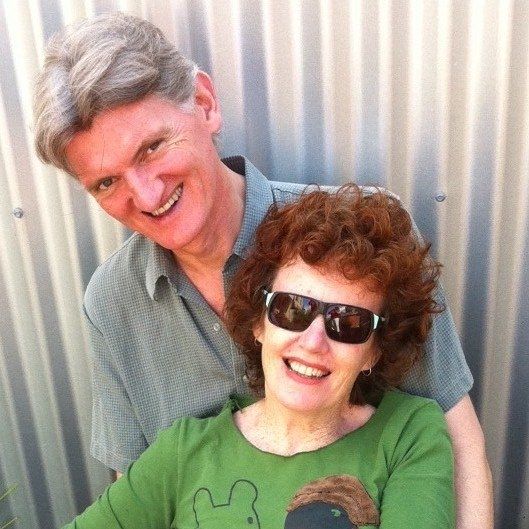
We walked the first 55 miles of the 185-mile Thames Path in 2018, following the river from its source to Oxford with our friend Geoff and his 11-year-old son Finn. This year, the four of us are walking from Oxford, the ‘City of Dreaming Spires’, to Henley-on-Thames, a journey of some 50 miles. Read More
Walking the Burren Way, Ireland
The Burren Way in Ireland is a 125-kilometre walking route from Lahinch on the wild west coast of County Clare. It follows ancient droving tracks, greenways and county byways through the heartland of the Burren to Corofin village. A five-day walk across the largest karst limestone landscape in Europe. It’s an immersion in Irish history and culture and an exploration of natural and archaeological riches including neolithic tombs, ring forts, early medieval castles and ancient centres of learning.
Burren comes from the Irish word, Boireann, a ‘rocky place’, a landscape of bare hills and lowlands. A tilted, folded, glaciated land of limestone pavements, hazel scrub, deciduous woodland, rare wildflowers, lakes, turloughs, springs, fens and grasslands. Its cliffs, escarpments and twisted hills are pale grey. On days when the sea and the sky have a shifting soft paleness, the landscape is more ethereal than existent. A subtle and abiding beauty.
Read More
